


De la farléde vers l'ozone à La Valette

FSantoni
User
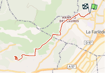

Length
12.4 km

Max alt
295 m

Uphill gradient
377 m
Km-Effort
17.4 km

Min alt
90 m

Downhill gradient
376 m
Boucle
Yes
Creation date :
2023-10-14 06:36:02.015
Updated on :
2023-10-14 14:39:58.71
5h31
Difficulty : Difficult

FREE GPS app for hiking
 SityTrail
IGN / Geographical institutes
SityTrail Plus
The world is yours!
About
Trail Walking of 12.4 km to be discovered at Provence-Alpes-Côte d'Azur, Var, La Farlède. This trail is proposed by FSantoni.
Description
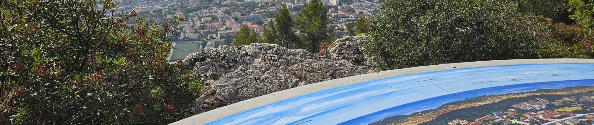
Peu de temps dispo ce samedi, juste assez pour cette rando trés moyenne, et avec peu d'interet si ce n'est la table d'orientation qui surplombe toute la rade de Toulon.
Photos

Positioning
Country:
France
Region :
Provence-Alpes-Côte d'Azur
Department/Province :
Var
Municipality :
La Farlède
Location:
Unknown
Start:(Dec)
Start:(UTM)
259376 ; 4783698 (32T) N.
Comments